How the Wildfire Lab fire simulator works
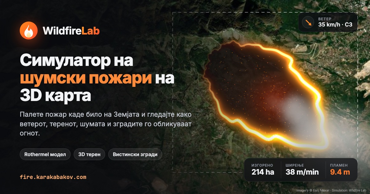
Wildfire Lab is a free wildfire simulator that runs in your browser. On real satellite imagery and 3D terrain of North Macedonia and the whole world, you start a fire, change the wind, temperature, humidity and rain, and watch the fire spread through forest, shrubland, fields and towns — with real buildings and roads from OpenStreetMap.
What you can do
- Start fires at a point or along a line, and run them in real time or sped up (1×–60×).
- Change the weather: wind speed and direction, gusts, temperature, humidity, rain and drought.
- Fight the fire: firebreaks, water drops and retardant lines.
- Analyse: arrival-time isochrones, a spread-risk map, the fuel model and per-cell details.
- See the impact: burned area, spread rate, flame length, fireline intensity, crown fire, spot fires and buildings lost.
How is fire spread calculated?
The head-fire rate of spread uses a model based on Rothermel (1972):
R = R₀ · ηM · (1 + φW + φS)
where R₀ is the base rate for the fuel type, ηM is moisture damping, φW is the wind factor and φS the slope factor. Wind and slope are added as vectors, and spread in every other direction follows an ellipse with the length-to-breadth ratio from Anderson (1983). Fire moves by minimum travel time over 32 directions, so the grid doesn't impose square shapes.
| Process | Method |
|---|---|
| Dead fuel moisture | Equilibrium moisture from temperature and humidity (Simard 1968), plus rain and water drops |
| Crown fire | Intensity threshold from Van Wagner (1977) |
| Intensity and flames | Byram (1959): flame length = 0.0775 · I0.46 |
| Spot fires | Wind-blown embers landing at log-normal distances |
| Local wind | Ridges catch more wind, valleys are sheltered |
| Buildings | Ignite from nearby flames and especially embers, burn long and hot |
What data does it use?
- Terrain: elevation from Mapzen Terrarium (AWS Open Data).
- Satellite imagery: Esri World Imagery.
- Buildings, roads, rivers and land use: OpenStreetMap. Roads and rivers act as firebreaks.
- Vegetation: forest, shrub, grass and urban land from OpenStreetMap, filled in by classifying satellite image colours.
- Live weather: Open-Meteo.
Frequently asked questions
What is Wildfire Lab?
Wildfire Lab is a free wildfire simulator that runs in the browser. On real satellite imagery and 3D terrain you start a fire, change wind, temperature, humidity and rain, and watch the fire spread through forest, shrubland, fields and towns.
Is the simulation accurate?
The model follows published fire-behaviour equations and gives realistic orders of magnitude, but it is an educational tool. It is not calibrated for operational planning and must not be used for decisions during a real fire.
Can I simulate a fire anywhere in the world?
Yes. The map opens on North Macedonia with ready-made locations such as Matka Canyon, Vodno, Galičica, Pelister, Mavrovo, Kočani and Tikveš, and you can draw your own area of up to 40 km per side anywhere on Earth.
Why do wind and slope matter so much?
Wind tilts flames toward unburned fuel and dries it ahead of the front, and an upward slope does the same — fire runs uphill far faster than downhill. In the model, spread grows with wind speed and with the square of the slope.
Is Wildfire Lab free?
Yes. It is free and runs in any modern browser with WebGL, with no sign-up and nothing to install.
How to simulate a wildfire
- Choose a place from the pin menu, or press G and drag a rectangle on the map.
- In the Weather tab set wind, temperature, humidity, rain and drought, or load live weather.
- Choose Ignite (2) and click or drag inside the area.
- Press Space and follow burned area, spread rate and buildings lost.
- Use firebreaks, water and retardant to stop the fire.
Wildfire Lab is an educational tool, not for operational decisions. Author: Gjorge Karakabakov. Last updated: 17 October 2026.